Types of Transportation in Metro Manila in 2026
Navigating Metro Manila for the first time can feel overwhelming, especially with its busy roads, crowded train stations, and unpredictable traffic conditions. As the capital region of the Philippines, Metro Manila is composed of 16 cities and one municipality, including major travel and business hubs such as Manila, Makati, Quezon City, Pasay, Taguig, Pasig, Mandaluyong, and Parañaque. Despite the traffic, the city offers several transportation options that make it easier for travelers to move between airports, hotels, tourist attractions, shopping centers, and business districts.
Getting around Manila in 2026 is now easier thanks to improved train systems, ride-hailing apps, and transport networks. Travelers visiting the Philippines for the first time often find that understanding Metro Manila transportation ahead of time helps save both time and stress. Whether you are backpacking, sightseeing, or traveling on a budget, learning how to commute around Metro Manila is an important part of the experience.
Table of Contents
What Is the Best Way To Get Around Metro Manila in 2026?
The best transportation option in Metro Manila depends on your destination, schedule, budget, luggage, and comfort level. Some travelers prioritize convenience and safety, while others focus on finding the cheapest transportation around Manila. Because traffic conditions can change rapidly throughout the day, many locals combine multiple transportation methods depending on where they are going.
For most foreign tourists and first-time visitors:
- Motorcycle taxis are often the fastest option during heavy traffic,
- MRT and LRT trains are the fastest during rush hour,
- while jeepneys, buses, and UV Express vans remain the cheapest ways to commute around Metro Manila.
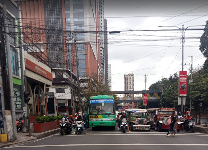
Traffic congestion continues to be one of the biggest transportation challenges in the Philippines, particularly along major roads such as:
- EDSA
- C5 Road
- Roxas Boulevard
- Quezon Avenue
- and major intersections near Makati CBD, Ortigas Center, and Bonifacio Global City (BGC).
Rush hour in Metro Manila usually occurs between:
- 7:00 AM to 10:00 AM
- 5:00 PM to 8:00 PM
Planning your travel schedule outside these hours can significantly improve your experience, especially when traveling between airports, hotels, and tourist attractions. Travelers searching for:
- best transportation in Metro Manila for tourists
- how to commute in Manila
- how to get around Manila without a car
- or cheap transportation options in the Philippines
will find that Manila now offers more transportation choices compared to previous years.
MRT and LRT Train Guide for Tourists in Manila
If you want to avoid heavy Manila traffic during busy hours, the MRT and LRT train systems are often the fastest public transportation options available. The train network connects important business districts, shopping centers, universities, government offices, and tourist attractions throughout Metro Manila. For budget-conscious travelers, train travel remains one of the cheapest and fastest ways to move around the city.
Many travelers use the train system when traveling between:
- Makati,
- Quezon City,
- Pasay,
- Manila,
- and Ortigas.
MRT-3: Fastest Way Along EDSA
The MRT-3 runs along EDSA, one of the busiest roads in Metro Manila. This line is especially useful for travelers staying near shopping malls, office districts, hotels, and transport terminals. Many commuters rely on the MRT-3 daily because it significantly reduces travel time during rush hour compared to road transportation.
Popular MRT-3 stations include:
- North Avenue
- Cubao
- Ortigas
- Shaw Boulevard
- Guadalupe
- Ayala
- Taft Avenue
The MRT is useful for travelers staying in:
- Makati,
- Ortigas,
- Mandaluyong,
- Pasay,
- and Quezon City.
Many malls and office buildings are directly connected to MRT stations, making transfers easier during rainy weather or busy weekends.
LRT-1: Best for Historical Manila Attractions
The LRT-1 is one of the most useful train lines for travelers exploring historical attractions around Manila. It connects several important cultural and tourist destinations while helping visitors avoid heavy traffic around the city center.
The LRT-1 is one of the most useful train lines for travelers exploring historical attractions around Manila. It provides convenient access to popular destinations such as Intramuros, Rizal Park, Binondo Chinatown, Manila Ocean Park, and the National Museum Complex. Many tourists use the line to avoid heavy traffic while visiting cultural and heritage sites across the city.
The line connects northern and southern Metro Manila through areas such as Baclaran, Pasay, Manila, and Caloocan. Travelers planning a historical walking tour around Manila often rely on the LRT-1 to reduce travel time between attractions while exploring the capital more efficiently.
LRT-2: Convenient for Eastern Metro Manila
The LRT-2 connects Manila to eastern cities including:
- Marikina
- Pasig
- and Antipolo.
Compared to MRT-3, this line is often less crowded and more comfortable during regular commuting hours. Travelers heading toward Rizal Province or eastern Metro Manila frequently use this route for easier city access.
The line also provides convenient access to:
- Cubao shopping centers,
- university districts,
- and nearby mountain destinations in Rizal.
Important Train Travel Tips in Manila
Train systems in Metro Manila can become extremely crowded during weekday rush hour. Travelers unfamiliar with Manila commuting may initially find stations confusing or overwhelming, especially during busy periods. However, after a few rides, many visitors become more comfortable navigating the train system.
Helpful commuter tips include:
- Use a reloadable beep card.
- Avoid peak hours when possible.
- Secure valuables in crowded stations.
- Follow station signage carefully.
- Prepare for long queues during weekdays.
If you are traveling with large luggage, trains may become difficult during rush hour. Many tourists instead prefer Grab or airport transfers when carrying multiple bags.
For train schedules and updates, travelers can also visit:
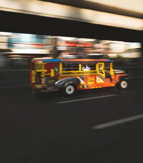
Jeepneys: The Most Iconic Public Transport in the Philippines
Riding a jeepney in Manila remains one of the most authentic local travel experiences in the country. Originally inspired by leftover military jeeps after World War II, jeepneys eventually evolved into one of the most recognizable symbols of Philippine transportation and street culture.
Modern jeepneys still operate throughout:
- Manila,
- Quezon City,
- Pasig,
- Makati,
- and nearby provinces.
What Travelers Should Expect When Riding Jeepneys
For first-time travelers, jeepneys can initially feel confusing because routes are not always clearly marked and stops can vary depending on passenger requests. Drivers may also communicate mostly in Filipino, especially outside tourist-heavy districts.
Still, many travelers enjoy jeepneys because they are affordable, widely available, and deeply connected to everyday Filipino culture. For many visitors, riding a jeepney becomes one of the most memorable local transportation experiences in the Philippines. The colorful vehicle designs and unique commuting style also make jeepneys a recognizable symbol of Filipino street life.
Before boarding a jeepney, travelers should ask the driver if the route passes their destination, especially when visiting unfamiliar areas in Metro Manila. It is also helpful to prepare small bills or coins for easier fare payment and observe how locals pay and signal their stops during the ride.
EDSA Carousel Bus System
EDSA Carousel: Affordable Bus Transport Across Metro Manila
The EDSA Carousel Bus System has become one of the most important transportation services in Metro Manila in recent years. Operating along EDSA, these buses connect major cities and business districts across the capital region. Many commuters and travelers now rely on the carousel because it provides a more organized and affordable alternative to traditional city buses.
The EDSA Carousel passes through important locations including:
- Monumento
- North Avenue
- Cubao
- Ortigas
- Ayala
- MOA Complex
- and PITX
Dedicated bus lanes help reduce travel time compared to regular traffic along EDSA. For budget-conscious travelers staying near MRT stations, hotels, shopping malls, and airport districts, the carousel system can be a convenient transportation option.
UV Express Vans
UV Express Vans for Faster City-to-City Travel
UV Express vans are another common transportation option throughout Metro Manila and nearby provinces. These air-conditioned commuter vans travel fixed routes between business districts, residential communities, transport terminals, and nearby cities. Compared to jeepneys and regular buses, UV Express vehicles are often faster and more comfortable for medium-distance travel.
Many commuters use UV Express routes traveling between:
- Makati
- Ortigas
- Quezon City
- Fairview
- Alabang
- and Antipolo.
For travelers unfamiliar with Manila commuting, UV Express terminals may initially feel confusing because pickup points vary depending on location. However, many locals prefer them because they are air-conditioned and usually have fewer stops compared to traditional buses.
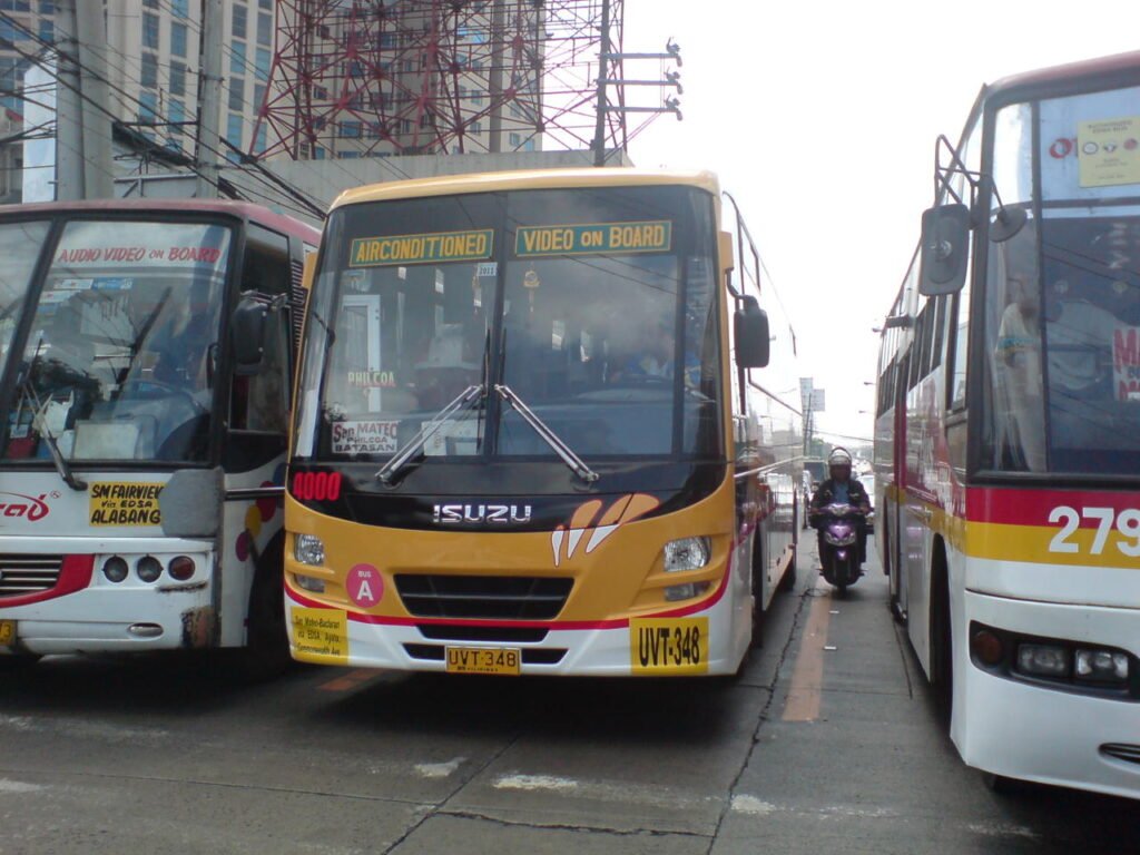
Traditional City Buses in Manila
City Buses Around Metro Manila
Traditional city buses continue to play a major role in Metro Manila’s transportation system. Despite the growth of trains and ride-hailing apps, buses remain one of the cheapest ways to travel long distances across the metro.
Bus routes commonly pass through:
- EDSA
- Taft Avenue
- España Boulevard
- Quezon Avenue
- and Commonwealth Avenue.
Travelers exploring Manila on a budget often use buses to reach destinations not directly connected by MRT or LRT train systems. However, road congestion can significantly affect travel time during weekday rush hours.
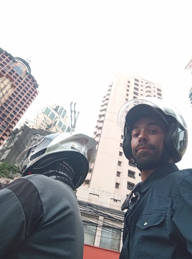
How To Use Ride-Hailing and Motorcycle Taxi Apps in Metro Manila
For many travelers, ride-hailing and motorcycle taxi apps in Manila remain some of the most reliable and convenient transportation options in 2026. These apps are widely used throughout Metro Manila, Cebu, Davao, and other major Philippine cities. Many tourists prefer app-based transportation because it feels safer, easier to navigate, and more convenient compared to hailing random taxis on busy streets.
Ride-hailing and motorcycle taxi services are especially useful for:
- airport transfers,
- hotel pickups,
- shopping trips,
- late-night travel,
- and navigating unfamiliar parts of Metro Manila.
Popular transportation apps in the Philippines include:
- Grab
- Angkas
- JoyRide
- Move It
Why Travelers Prefer Ride-Hailing Apps in Manila
One reason travelers prefer ride-hailing and motorcycle taxi apps over traditional taxis is the convenience and transparency offered by these platforms. Routes are GPS-tracked, fare estimates appear before booking, and digital payment options are available for travelers who prefer cashless transactions. These features help reduce the risk of overcharging or confusion during trips around the city.
Using ride-hailing apps in Metro Manila offers several advantages for both local commuters and international travelers. Features such as GPS-tracked routes, fixed fare estimates, digital payment options, and driver monitoring systems help make transportation around Manila more convenient and predictable. For travelers booking car rides, air-conditioned vehicles also provide added comfort during hot and humid weather conditions.
Motorcycle taxi services are also becoming increasingly popular because they can move through traffic faster than regular cars during peak hours. This makes them especially useful in heavily congested areas such as Makati, BGC, Ortigas, Pasay, and Quezon City, where traffic congestion can quickly affect travel times throughout the day.
Tips for Using Ride-Hailing Apps in the Philippines
Using ride-hailing and motorcycle taxi apps becomes easier when travelers prepare ahead of time. A stable internet connection is important because pickup locations can sometimes become confusing in crowded areas such as malls, airports, and transport terminals. Booking delays and surge pricing may also happen during heavy rain or rush hour.
Helpful tips include:
- Buy a local Philippine SIM card with mobile data.
- Use airport or mall pickup points when possible.
- Double-check pickup pin locations before confirming rides.
- Expect higher fares during peak traffic periods.
- Wear comfortable clothing when using motorcycle taxis.
Travelers may also enjoy:
- Do You Need Cash in the Philippines or Can You Use Cards Everywhere
- NAIA 2026 Updates: What’s New at Manila Airport This Year
For official information, travelers can also visit:
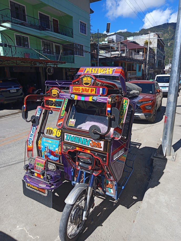
Tricycles in Manila and Nearby Cities
Tricycles for Short-Distance Local Travel
Although tricycles are more common in provincial areas, they are still available in certain parts of Metro Manila and nearby cities. Tricycles are commonly used for short neighborhood trips and local transportation routes not directly accessible by jeepneys or buses.
Travelers often encounter tricycles near:
- residential communities,
- local markets,
- barangays,
- and smaller side streets.
For travelers wanting a more local commuting experience in the Philippines, tricycle rides remain one of the country’s most recognizable transportation experiences.
Walking Around Tourist Areas in Manila
Walking in Intramuros, BGC, and Makati
Several parts of Metro Manila are surprisingly walkable, especially within modern business districts and historical areas. Many travelers enjoy exploring these areas on foot because walking allows them to experience local food, architecture, and street culture more closely.
Popular walkable areas include:
- Intramuros
- BGC
- Makati CBD
- Rizal Park
- Binondo Chinatown
Walking tours often help travelers discover:
- hidden restaurants,
- local cafes,
- museums,
- heritage buildings,
- and cultural landmarks that are easy to miss while commuting by vehicle.
Comfortable footwear, hydration, and lightweight clothing are highly recommended because Manila weather can become extremely hot and humid during daytime hours.
Airport Transportation From NAIA in 2026
The Ninoy Aquino International Airport (NAIA) remains the country’s main international gateway. Transportation options from NAIA include GrabCar, airport taxis, hotel shuttles, buses, and car rentals. Because the airport terminals are spread across different parts of Pasay and Parañaque, transfer times can vary significantly depending on traffic conditions.
Travelers arriving during evening rush hour should prepare for possible delays when traveling between:
- NAIA terminals,
- Makati,
- BGC,
- and Quezon City.
Pasig River Ferry: Alternative Water Transportation in Manila
One of the more unique ways to travel around Metro Manila is through the Pasig River Ferry Service. The ferry connects several cities including Manila, Makati, Pasig, and Mandaluyong while offering scenic river views away from road congestion.
Although not commonly used by tourists, the ferry provides a quieter alternative to crowded roads and train stations. Some travelers enjoy using the ferry to experience a different side of Metro Manila transportation.
For ferry updates, travelers can also visit the Maritime Industry Authority.
Is It Safe To Commute Around Metro Manila?
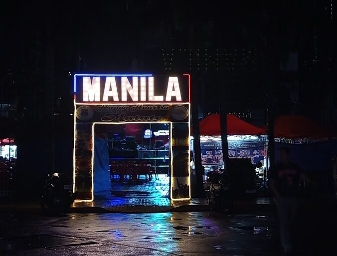
Metro Manila is generally safe for tourists, especially in major business districts, transportation hubs, shopping centers, and popular tourist attractions. Areas such as Makati, Bonifacio Global City (BGC), Ortigas, and Intramuros are commonly visited by both local and international travelers throughout the day. While commuting around Manila is usually manageable for visitors, travelers should still practice normal city precautions, particularly during rush hour and in crowded public areas.
When using public transportation in Metro Manila, it is important to stay alert and keep personal belongings secure, especially inside busy train stations, jeepneys, and buses. Travelers should avoid displaying expensive gadgets or valuables openly and use trusted ride-hailing apps whenever possible. It is also advisable to avoid poorly lit streets late at night and remain aware of surroundings while commuting around unfamiliar parts of the city.
Travelers may also enjoy:
- Emergency Contacts Philippines: What to Do When Things Go Wrong
- Safety First: Risk Management for Solo Adventure Travelers in Remote Areas
Conclusion
Getting around Metro Manila in 2026 can seem intimidating at first, but travelers now have more transportation choices than ever before. From MRT and LRT trains to ride-hailing apps, jeepneys, buses, UV Express vans, ferries, and motorcycle taxis, exploring the Philippine capital has become far more accessible for both local and international visitors.
With proper planning, flexible schedules, and a basic understanding of Manila’s transportation system, traveling around the city becomes much easier and less stressful. Whether you are visiting historical attractions in Manila, shopping in Makati, exploring BGC, or commuting like a local, learning how to navigate Metro Manila is an important part of experiencing the Philippines itself.
Follows us on Facebook
Tips and Tricks
- Bringing Regulated Items
- Transport Options
- Popular Destinations
- Religion in the Philippines
Travel Adventures Diary
- Adventure Tours in Manila
- Adventure Tours on Bantayan Island
- Adventure Tours in Cebu
- Adventure Tours on the Island of Negros
- Adventure Tours Siquijor
- Adventure Tours in Guimaras
- Adventure Tours Gigantes
- Adventure Tours in Metro Manila
- Adventure Tours Puerto Princesa
- Adventure Tours in El Nido
- Adventure Tours in El Nido and Puerto Princesa
- Adventure Tours Baguio City
- Adventure Tours Sagada
- Adventure Tours Buscalan
- Adventure Tours Banaue
- Adventure Tours Pangasinan
- Adventure Tours Hundred Islands
- Adventure Tours in Metro Manila
- Adventure Tours in Leyte
- The Bamboo Paraiso Beach Resort
- Best Tour in Pangasinan